The Kugururok River is a little-visited river that flows south out of the peaks of the DeLong Mountains in the western Brooks Range and ends at its confluence with the famed Noatak River. We will paddle the entire navigable length of the river and a few miles on the Noatak. In addition to packrafting, there will be plenty of time to explore, and the hiking, fishing, birding, and wildlife watching will keep us smiling through-out.
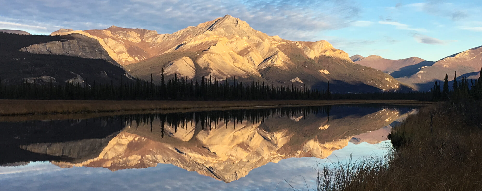
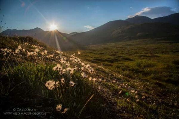
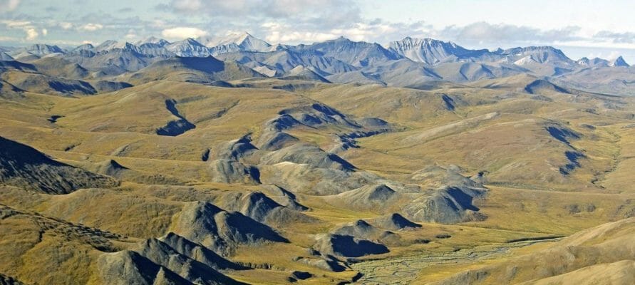
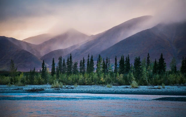
The entire watershed of the Noatak, including the Kugururok River, is protected within the Noatak National Preserve, one of largest protected areas in the country. It’s a sprawling, roadless wilderness of mountains, rivers, lakes, and rolling tundra hills. The Kugururok begins as a series of small rocky creeks flowing from dramatic mountains with names like Inaccessible Ridge and Copter Peak. As we descend the Kugururok River, the tundra will slowly be populated with spruce trees, until in the final days we are surrounded by boreal forest. Observing this change over the course of the trip is one of it many pleasures.
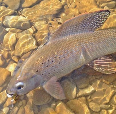
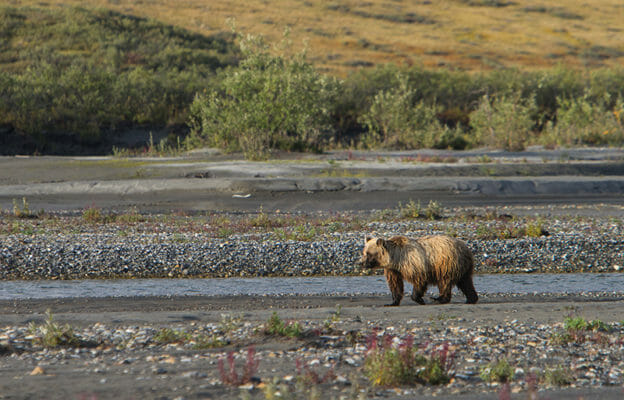
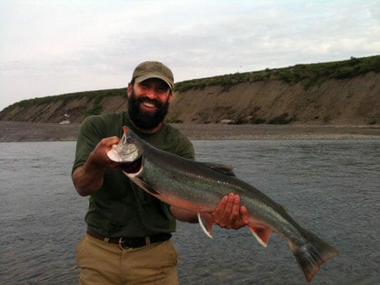
This trip is in mid-summer. Bears are busy fishing, caribou are milling here and there, and the tundra is dotted with ripe berries. Char should be starting to return to the river after a summer at sea. In addition to Char we can expect to find grayling and pike.
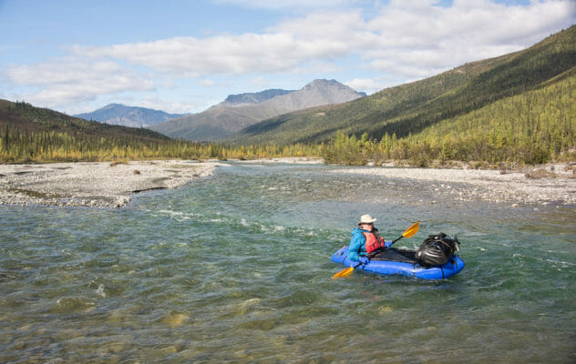
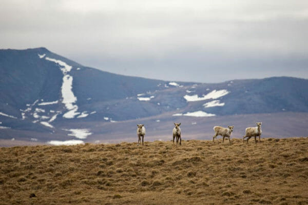
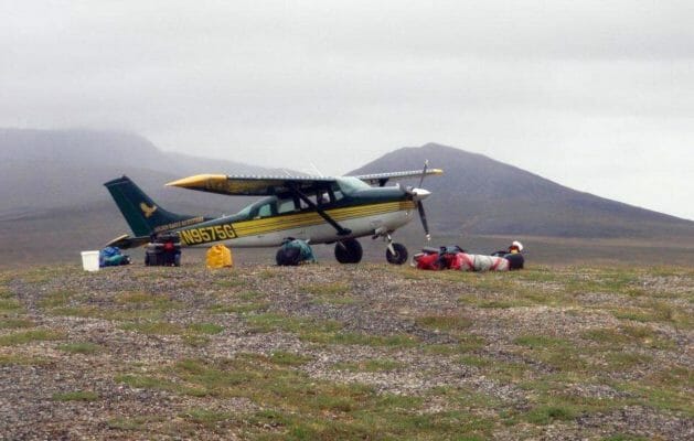
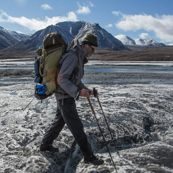
After flying up the river and accessing water levels we will land at the upper limit of navigability. Here we’ll start our paddling trip, still well north of tree-line and heading south towards the expansive Noatak Valley. The next morning we’ll assemble our boats, load up, and after an instructional session, head down river. As we paddle down the Kugururok, we’ll keep our eyes open for the valley’s wildlife: grizzly bears, caribou, moose, foxes, and wolves. Some years great numbers of caribou use the Kugururok River Valley as a preferred route north to calving grounds on the coastal plain. There could be lots of bulls still migrating up the valley.
The river starts small and grows with each incoming side creek. Though there are no rapids per se, the river is quick in spots and offers some fun challenges. Your guide will offer pointers on how to safely navigate the ever-changing river, but you have control of your boat and will gain knowledge and skill each day.
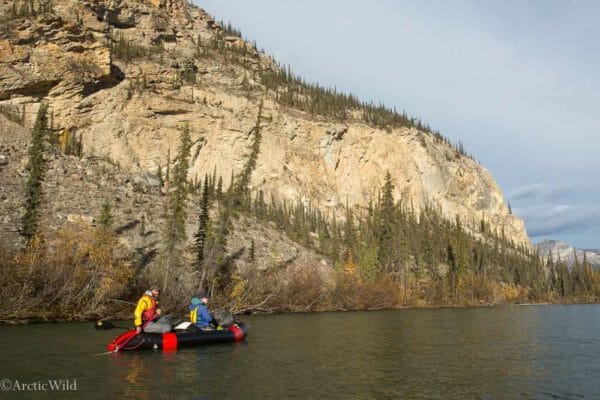
About mid-way down the river we enter a lovely canyon with sheer walls and nesting raptors. It is one of the prettiest places in all the Brooks Range and very seldom visited.
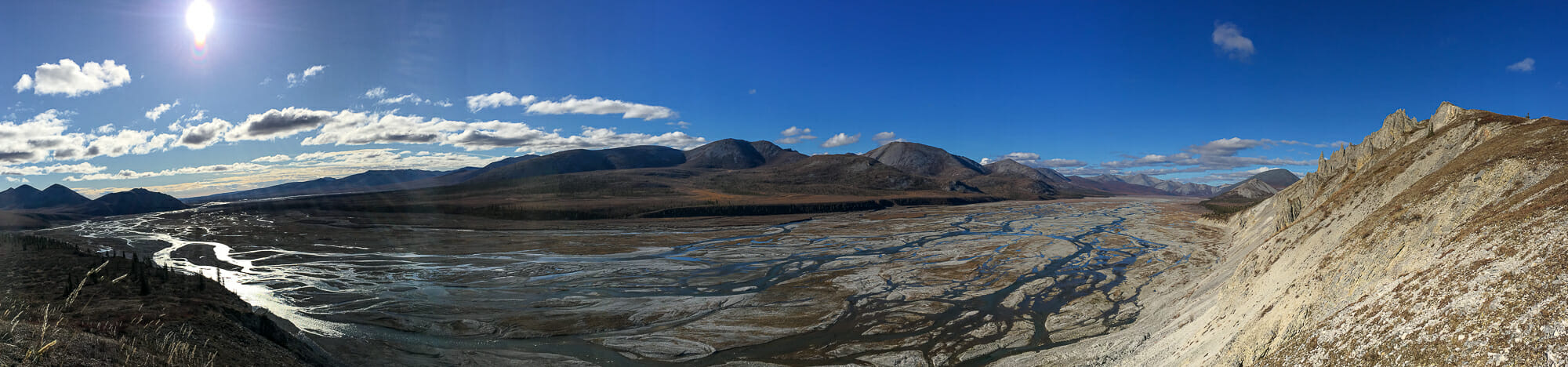
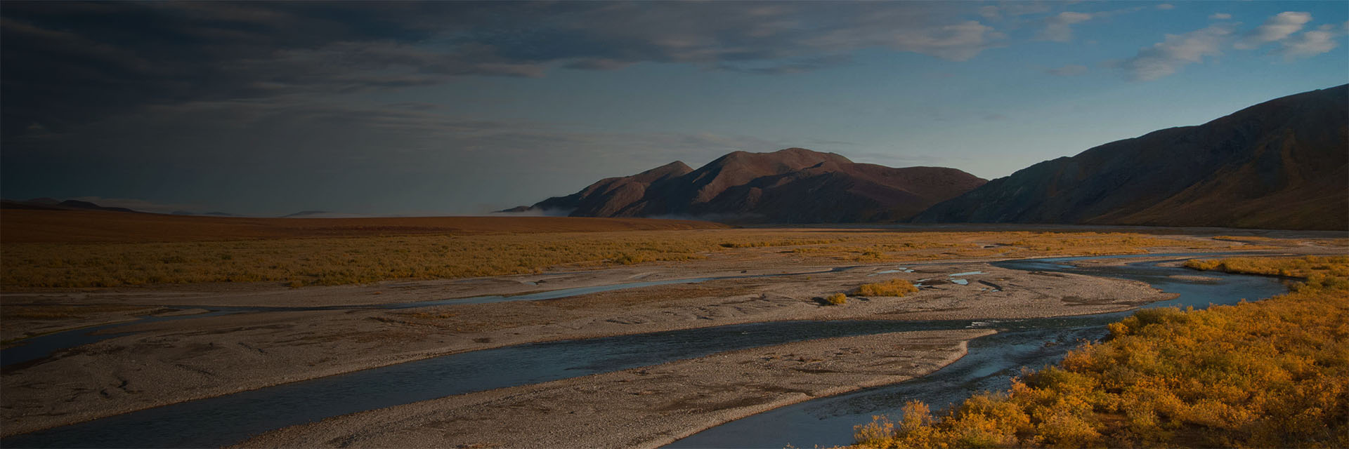
Below the canyon the river bends first towards one set of mountains and then arcs the other way to the opposite ridges meandering in an ever widening floodplain. Beyond the river willows are rocky ridges, broad tundra flats, lakes, and ponds. As the Kug descends in both elevation and latitude you’ll enter the shelter of the boreal forest and will encounter new birds, and new sights.
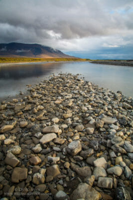
At the mouth of the Kug we will camp on a huge gravel bar along the Noatak the sky growing wide above the placid river. Compared to the Kug the Noatak will appear enormous but after a few miles we will get used to the speed and width of the Noatak and can spend a few days exploring the broad gravel bars and fishing along the cut banks for salmon, dolly varden, and grayling.
After a day on the Noatak we arrive at the confluence of the Kelly River for a final camp and beach fire. There, we’ll pack our boats, and set up our tents for the final time. After one more night listening to river sounds, weather permitting, a bush plane will arrive to whisk us back to Kotzebue.
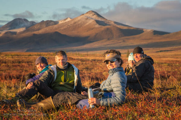
This is a fairly easy river trip in terms of mileage and distance covered, but you can fish, hike, explore, and bird-watch until you’re worn out. The Kugururok flows along with current enough to keep us moving, but if the wind blows opposite the current we will have to work to reach each day’s end. The trip is suitable for beginning or experienced paddlers. There is some chance the water will be high and muddy making the paddling more technical.